LiDAR-Based Localization & Environment Recognition for an Autonomous Aerial Vehicle
A multi-sensor localization and environment recognition pipeline integrating LiDAR, camera, and IMU data for autonomous navigation and 3D scene understanding.
Project Overview
This project focuses on developing a multi-sensor localization and environment recognition pipeline for an autonomous aerial vehicle operating in a simulated environment. The system integrates LiDAR, camera, and IMU data to estimate the vehicle's motion, evaluate its trajectory, and recognize and localize objects in the surrounding environment.
The project combines classical robotics and state-estimation methods with learning-based perception to provide an integrated framework for autonomous navigation and environmental understanding.
Project Resources
Source code and detailed project documentation.
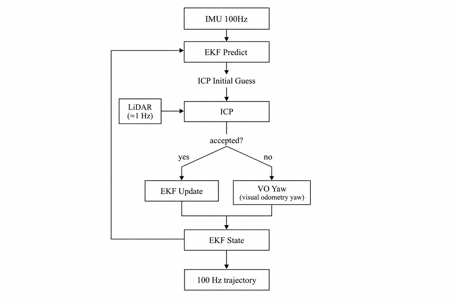
Autonomous aerial vehicle localization and environment recognition pipeline
Project Snapshots
Selected visual results from the project.
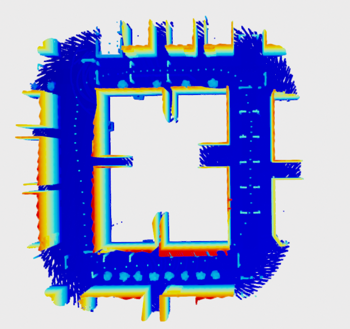
LiDAR-Based Localization
LiDAR point cloud processing and motion estimation.
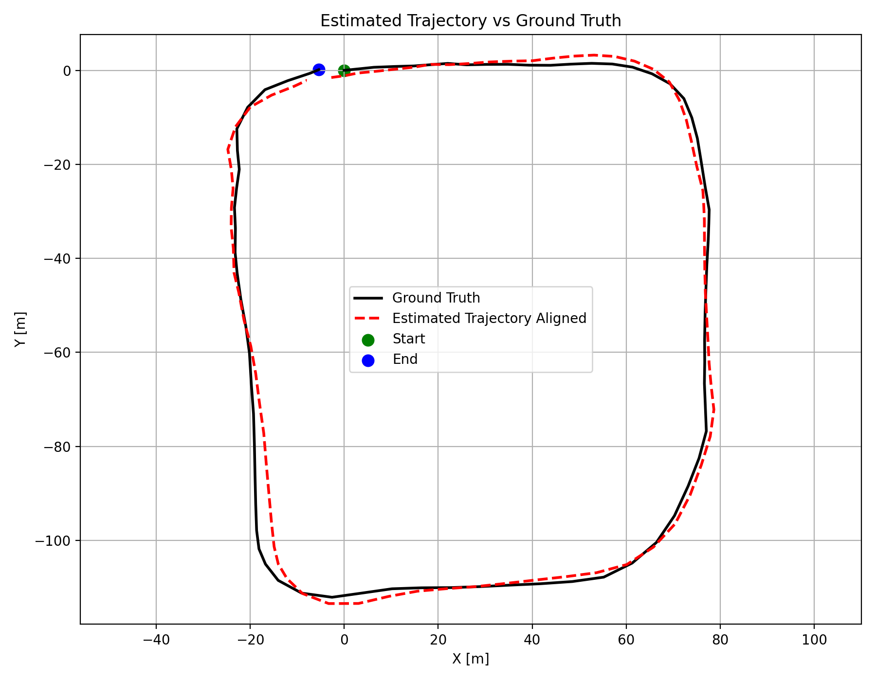
Trajectory Evaluation
Estimated vehicle trajectory and ground-truth comparison.
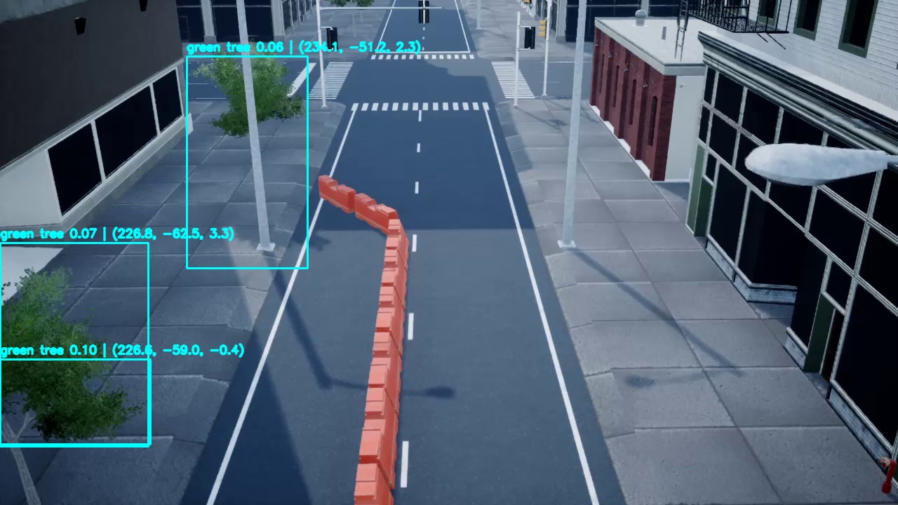
Visual Odometry
Camera-based motion estimation using visual features.
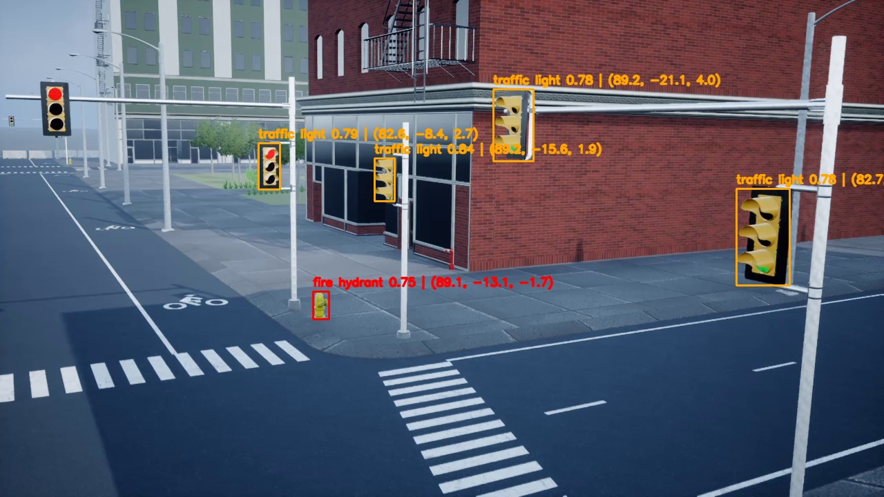
Environment Recognition
Object detection and 3D localization within the environment.
Project Demo
A visual demonstration of the implemented system.
Technologies & Methods
Tools, algorithms, and techniques used throughout the project.
Documentation
Project Report
Detailed methodology, implementation, experiments, and results.